We split up. Betsy drove the Sprinter south to Lone Pine while I flew my plane, loaded with camping gear and an electric bike, out into Nevada to explore the ghost town of Goldfield. We would meet up in a day or two.

I hit my target of arriving at Goldfield before sunset, a necessity because of the gravel runway and mountains nearby. The FAA database said “Gravel in good condition”, but after three low passes to inspect the runway I finally determined not to land there. I could see someone dug doughnuts in the runway with a vehicle and I just wasn’t sure. Best not to end up breaking my plane.
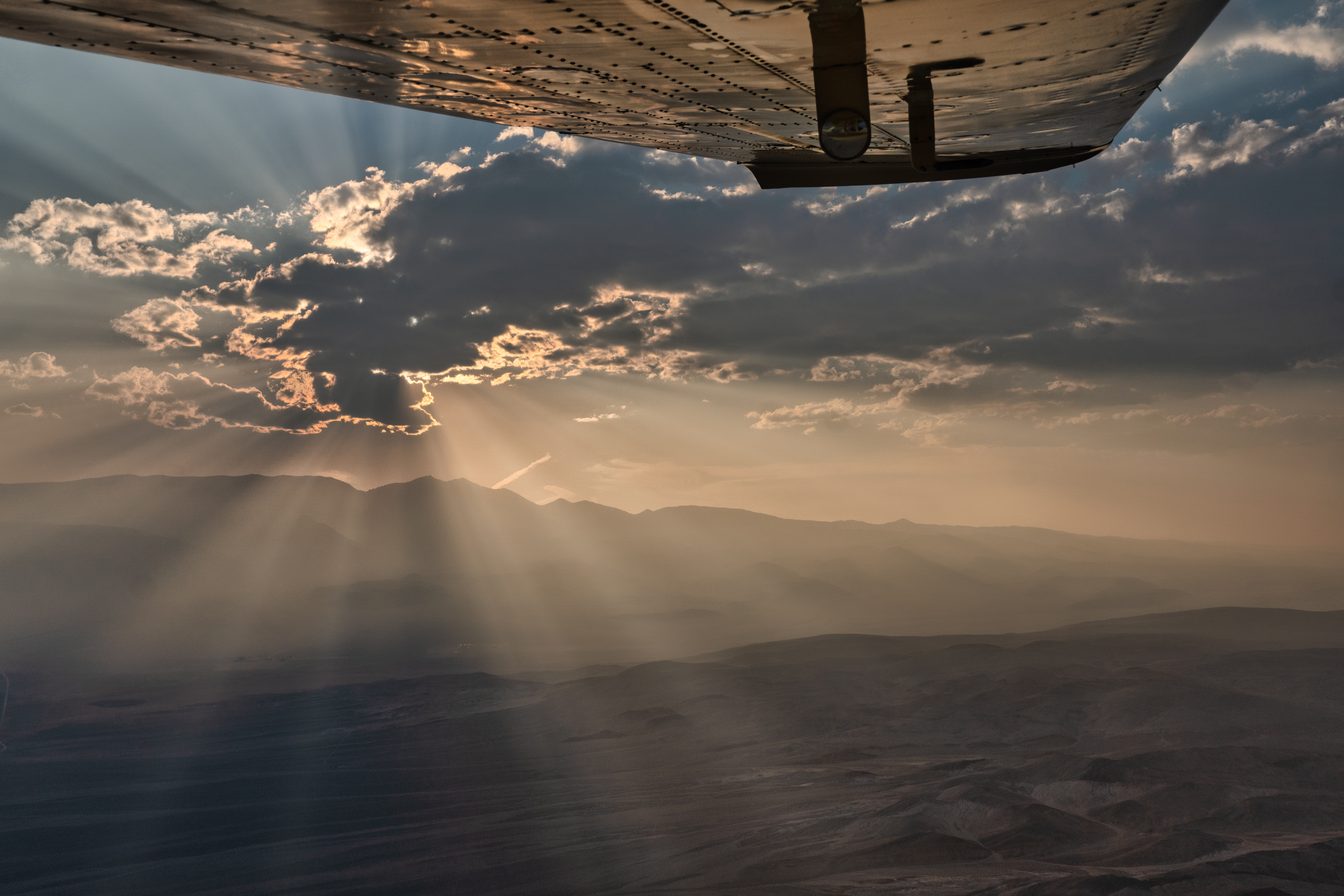
But now I have a predicament because it is 15 minutes before sunset. The visibility is poor in thick smoke (the “god rays” in the photo are from wildfire smoke and it was much worse in Goldfield). Bishop was reporting 1.5 miles of visibility (that’s bad, especially in the mountains) and in fact I couldn’t legally land there without filing an IFR flight plan and flying an approach.
I think Mammoth or Lee Vining is better, and Betsy is probably going to stop for the night near Lee Vining at a semi-secret camp spot we know of. In fact after my last low pass I instinctively started flying west. However Lee Vining is 30 minutes away and by the time I get there the sun will be down and there will only be enough light left for one or two attempts to land. Flying around big mountains in low visibility at night is not very smart.
Another option would be to fly the other way, into Nevada to Hawthorn or Tonopah where the reported visibility is better. I would be going the wrong way but it would leave me with more options should anything else go wrong.
So I turned around and flew further into Nevada to Tonopah. It is an enormous airfield because it was a training base during WWII, but it is empty and lonely now (and 8 miles from town) with only a handful of planes based there. I pulled in and pulled out my tent on the large ramp.
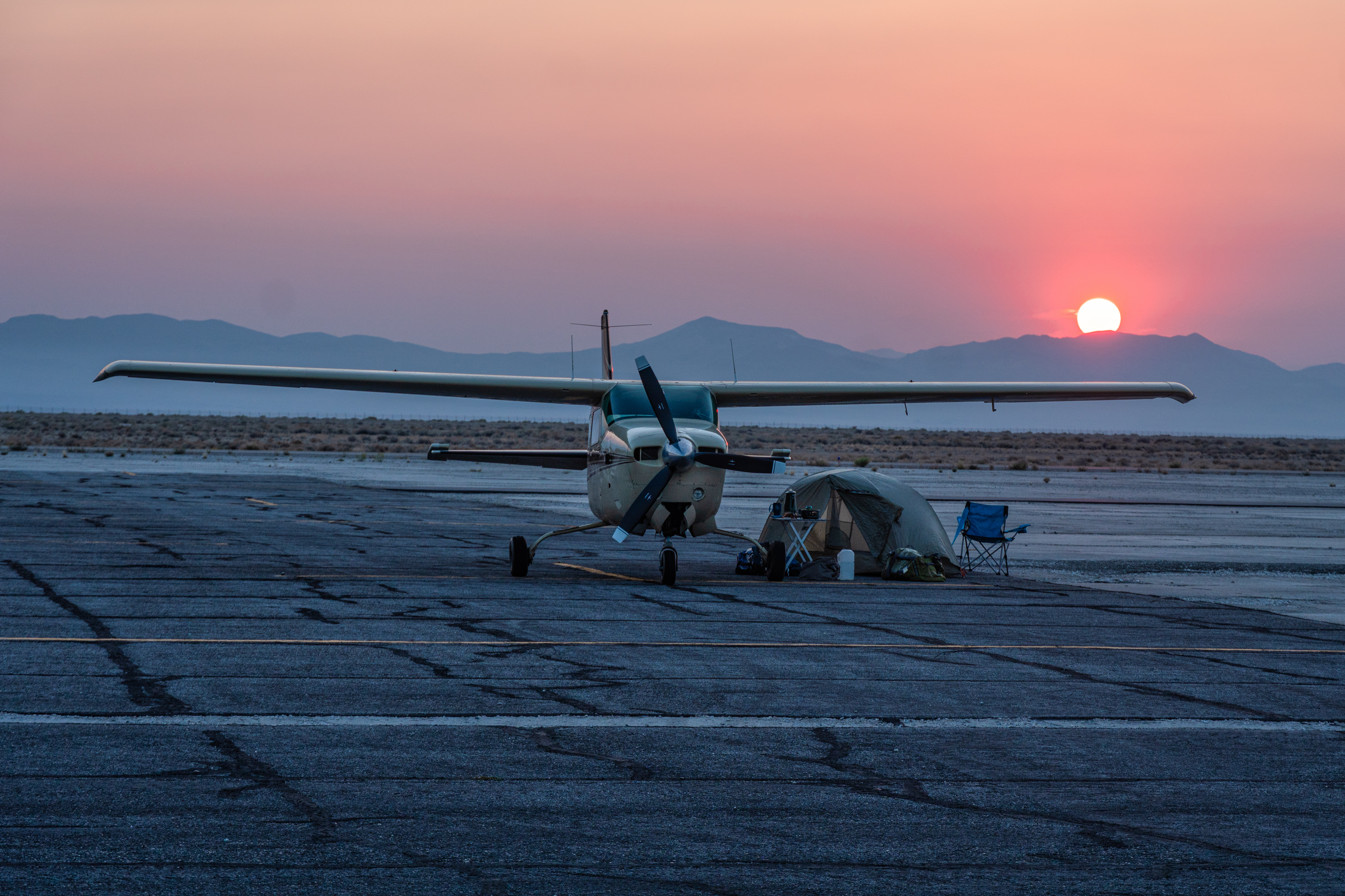
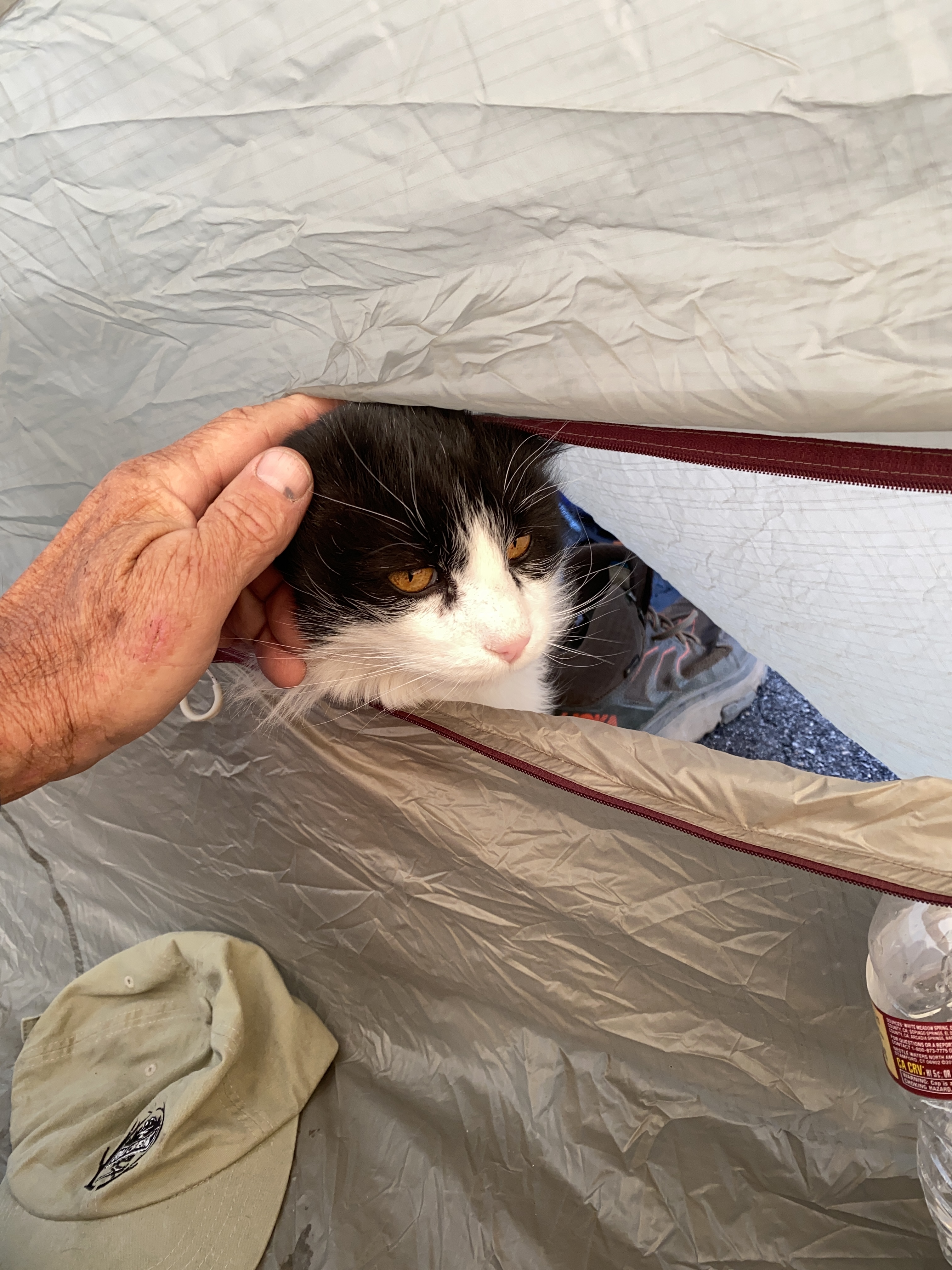
I had planned on eating at a diner in Goldfield but I’ve learned to be prepared so I dug into my cooler and had a bagged salad and a freeze dried chicken teriyaki dinner and even a cold beer. It was quite nice and I even had a visitor: an animal tried and even successfully got into my tent that night and again in the morning. There was no stopping it.
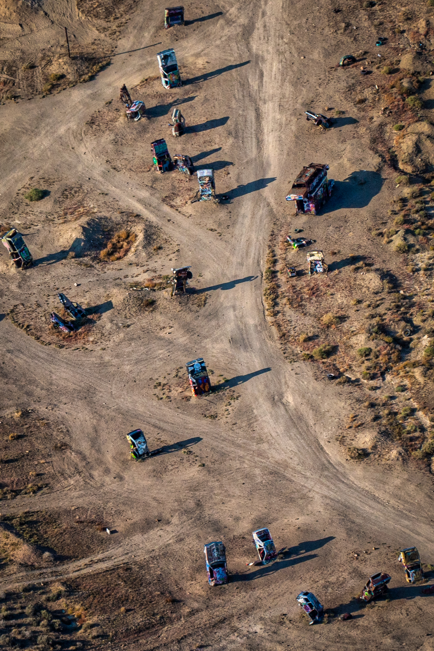
The next morning was clear so I went back over Goldfield, still not landing there, but got a few aerial photos. I then headed down to Lone Pine to meet Bets for our next adventure involving Mt. Whitney.


Looks like a neat place to visit. Looking at the AFD, it says PPR to land. Were you able to obtain that?
Hmmm. I used Foreflight and it doesn’t say that. I guess I should still check the AFD. It could have been very helpful had I called.
Goldfield has quite a Railroad History, one of the towns serviced with a railroad running from Las Vegas up to Tonopah. I understand a lot of the right-of-ways are still visible along the route. https://en.wikipedia.org/wiki/Las_Vegas_and_Tonopah_Railroad
Hi Allan – good to hear from you!
Great story and pics, as always! I could feel my stomach tensing a bit as you described deciding not to land on the doughnut and then trying to make the best alternate decision—in poor vis as darkness approached, while still flying the 210. Going from CAN’T to CAT (sorry) was a good choice, sounds like.
Hey – thank you for the comments – I appreciate that!
Good to see you staying safe out there while still pushing the envelope!😄
Bert Botta TWA/Netjets (ret) Aviation Expert Witness Aviation Writer Email: botajet@ me.com 415-320-9811 http://www.bertbotta.com
>