
In my last post I detailed one of my most challenging flights ever, to Phoenix. Fortunately the return trip was much milder. There were still clouds around, but now they were truly benign and easy to stay out of – which I gladly did.

When I flew into Deer Valley a few days prior it was eerily quiet because of the low clouds and wind. Now it was back to a bustling training airfield and I had to wait in line with about 10 small planes to take off.
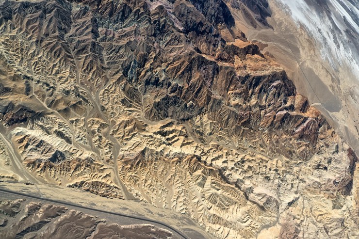
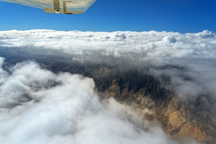
It was a more relaxing flight and I even took a detour over Death Valley and straight over to the Mt. Whitney area, then up Highway 395 climbing (again) to around 16,500 feet to get over the clouds. But this time it was only for a few minutes and I knew my destination was completely in the clear.
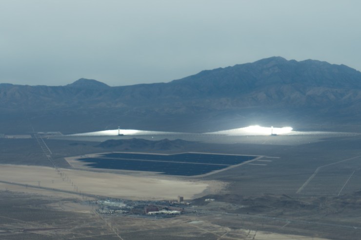
I flew by solar arrays of mirrors and one of them was shining on me but luckily I didn’t melt – it was just very bright. The mirrors are focused on a ball full of salt (I believe) at the top of the tower. The molten salt retains the heat and acts like a battery in order to use the power at peak power times, not necessarily peak sun times.


Both posts (there and back) are great reads and the photos are excellent too! Keep em comin!
Thanks Derek!
Just want to say Thanks for posting and sharing your adventures! Love viewing the pictures and reading your posts!! I always look forward to the next post!
Thank you! I appreciated the those comments!
Great posts. What weather source do you use to determine cloud tops? How accurate have you found the forecasts?
NWS has a product called something like, “Composite Radar with Tops”. It isn’t a forecast though, its based on actual radar returns. Very useful though and I’ve used it for years. The area forecasts would mention tops but I haven’t used those for a while.
Hi,
off topic, but, can you idenitfy this dirt landing strip that was used in filming the HBO series Barry?
Looks to be near Los Angeles.
In the series, they mention Lancaster, but, it’s flatter out there from what I found searching Airnav etc.
Thank you!
Interesting. I’m from Northern California so I don’t know the southern half very well. It is probably private and maybe uncharted. I know of a few around here that are not on a chart.
Thank you!
Love your blog, thank you very much!