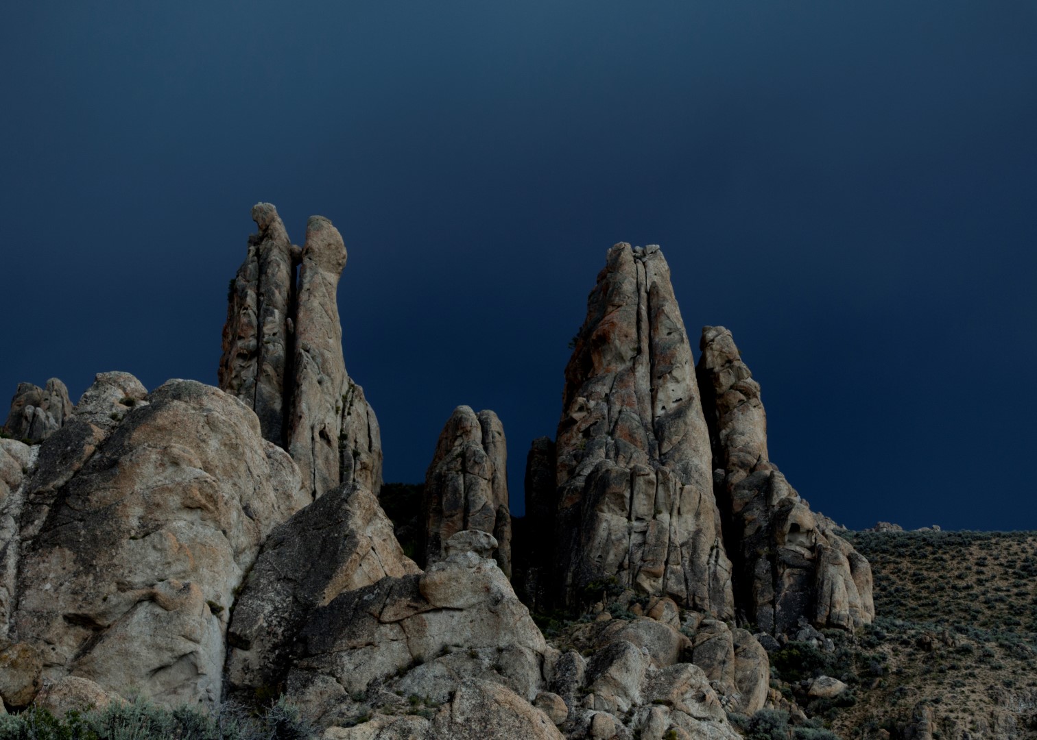
I looked out the airplane window to my left and saw in the distance spires rising out of the Nevada desert. Are those granite? There, close to the Black Rock Desert (aka home to Burning Man)? I looked at my watch to make sure I had enough time before my meeting in Salt Lake City, then banked the plane and descended for a closer look. The spires were indeed granite and looked tall enough for some interesting climbing. I thought it must be a known area, so I took some photos then banked away towards my meeting.
Research turned up very little so that settled it. Betsy and I had to go to this remote area of Nevada and find out what is really there.
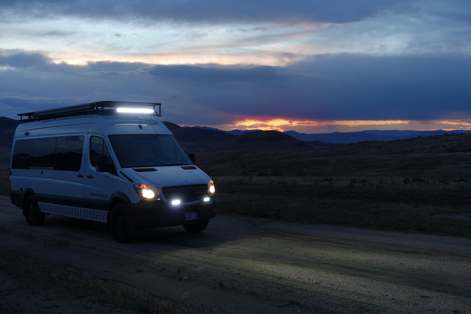
Betsy and I headed out after work on a Friday, stopping in Reno for dinner and then out into the Nevada wilds. We first ran into a rainstorm and flash flood, and wondered why every time recently when we drive into the Nevada desert where it never rains, it rains.

Soon we were on a decent mud-free dirt road, heading into the darkening desert.
In spite of GPS and modern Google/Bing Satellite previews of the roads, at one point during the evening we took a wrong turn and drove down to a gated private ranch – and we couldn’t back up in the mud nor could we turn around. We could only go down but were block by a gate. We crawled through a barbed wire fence, a cattle dog warily circling and barking, and slowly approached the ranch house. It was surrounded by corrals, pickup trucks and long multi-horse trailers – so I felt better that it was probably a cowboy’s bunkhouse rather than a private ranch with an old rancher sitting on his rocking chair with a rifle in his lap. Sure enough a couple of guys answered the door and said the gate wasn’t actually locked, it just looked like it and we could unwrap the chain and drive through. In fact, they said we could drive though a road on the ranch and meet up with the correct road later.
We spent the night just off the dirt road before we hit the “less traveled” road in the morning. It was definitely less traveled.
Time to air-down the tires!
The soft-tire bit really did the trick! Until it didn’t.

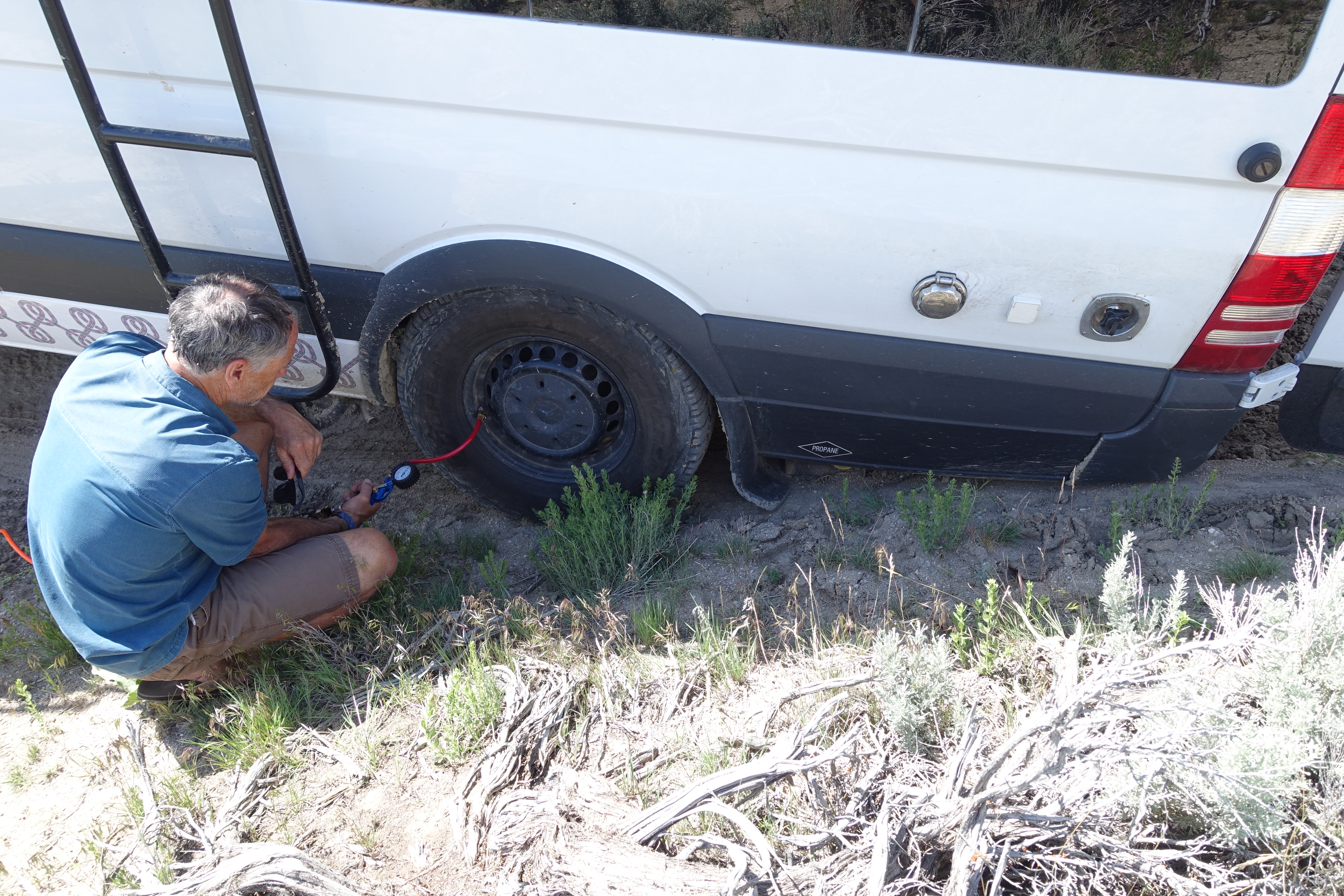
We bent the propane filler attachment and crammed dirt into the van’s battery box but didn’t seem to do other damage. We do have a satellite emergency beacon and lots of extra water but getting stuck out here would not have been fun.
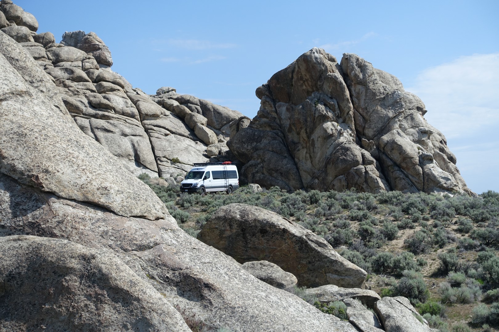
We finally make it. Not to where I had planned because another dry creek crossing scared us, but we certainly can’t complain about the camp site:
But don’t let your guard down. Right to the left from where this photo was taken Bodie, one of our dogs, leapt straight up like a cat and a buzzing sound ensued. Betsy and I stepped forward to inspect the rattlesnake under the rock, but not until I later looked at the photo on the computer did I see the second snake! We were close to that snake!

Betsy found a really cool spot where perhaps Indians made arrow heads. There were flakes of obsidian everywhere. We collected some of it for this photo, then spread it out again.


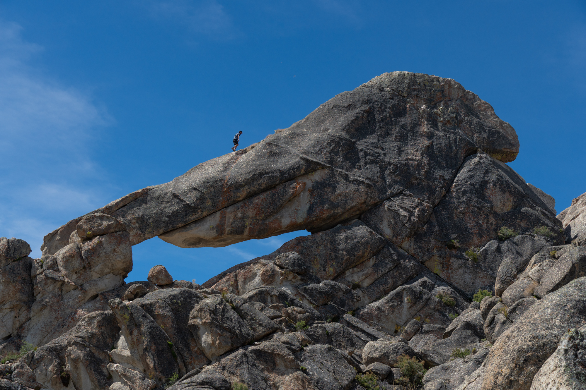
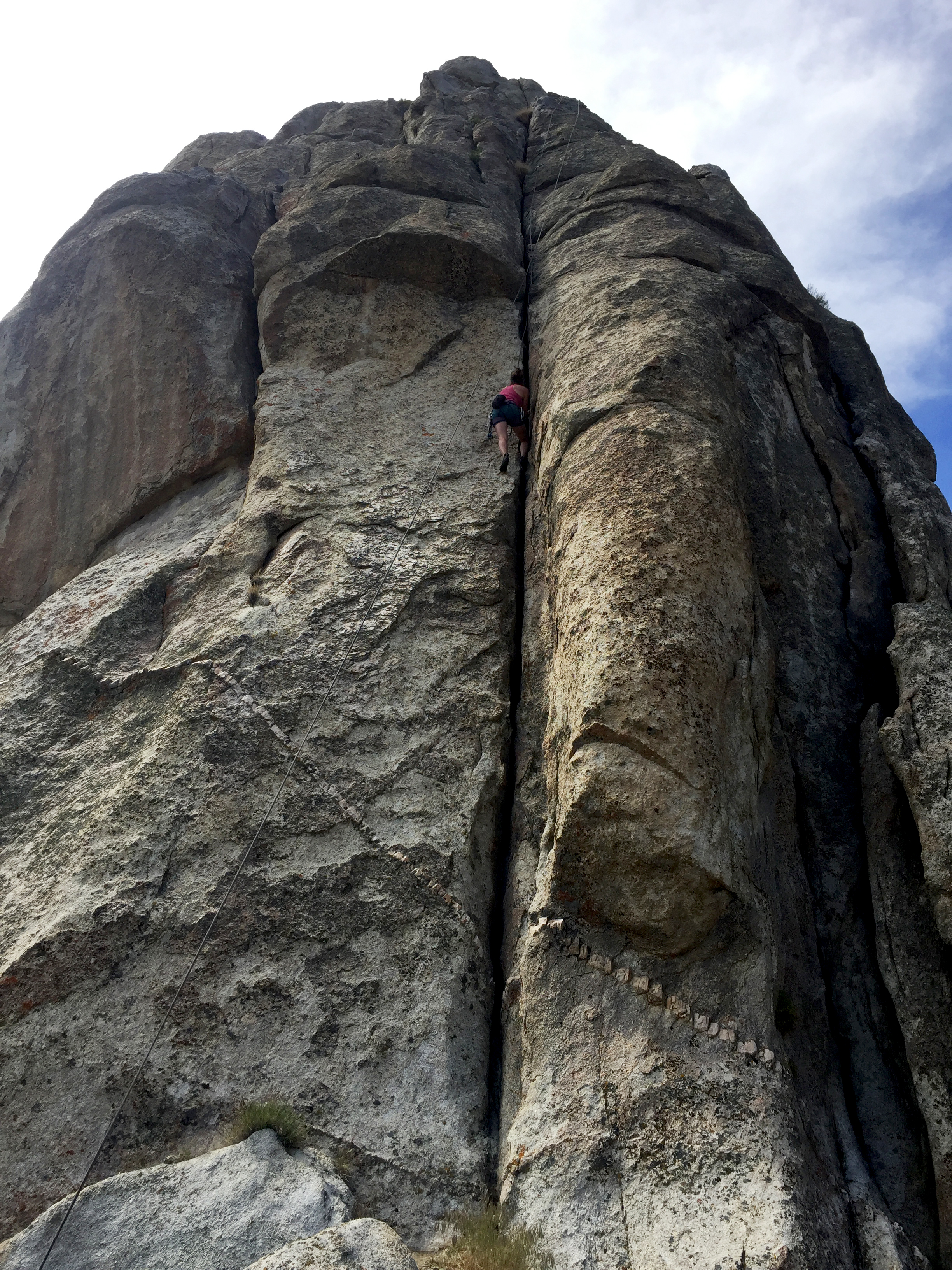
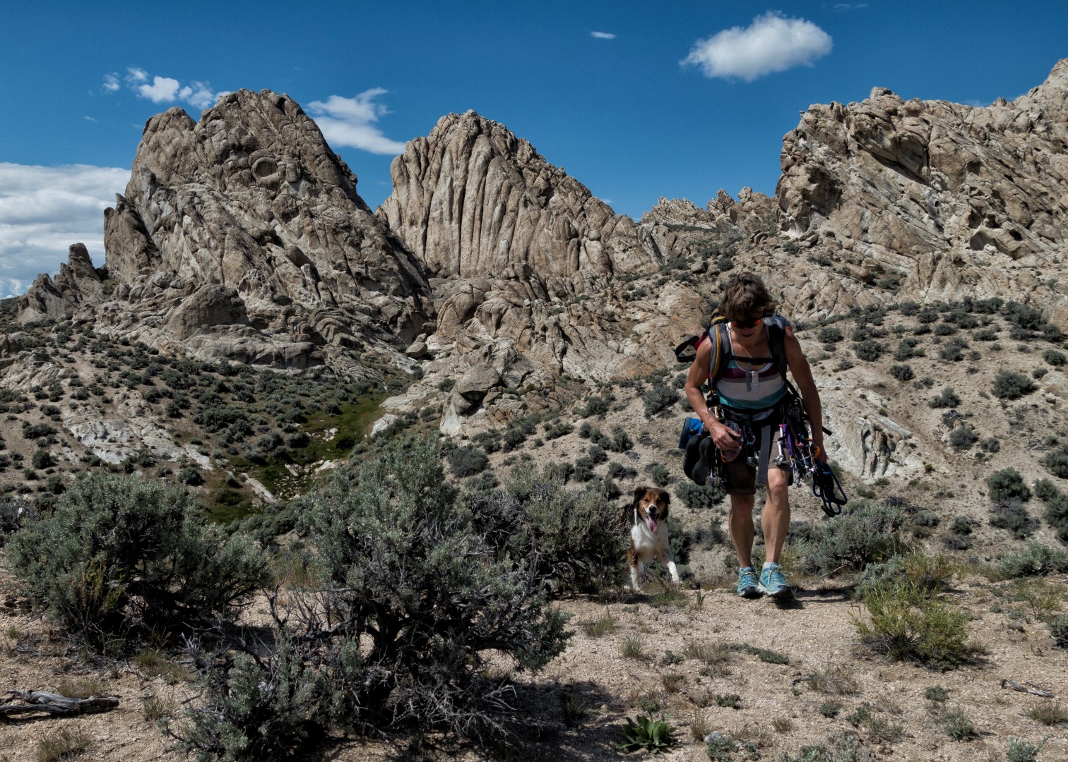
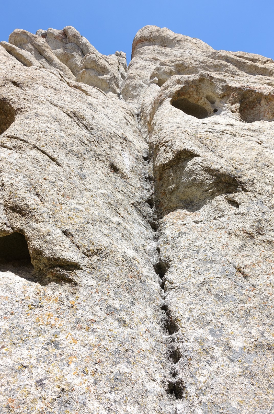
Oh yes, we came to climb. It was great and we did some probable first ascents. Betsy ended up leading the first crux pitch of a delicate climb called “South Spring Arete”. There were places for natural protection but you had to seek them out. The rock is rough and a little crumbly in spots on this spire.

There are many springs in the area which cows, wild horses, wild burros and one small fawn enjoy. We saw a lot of burros on the way in and out.

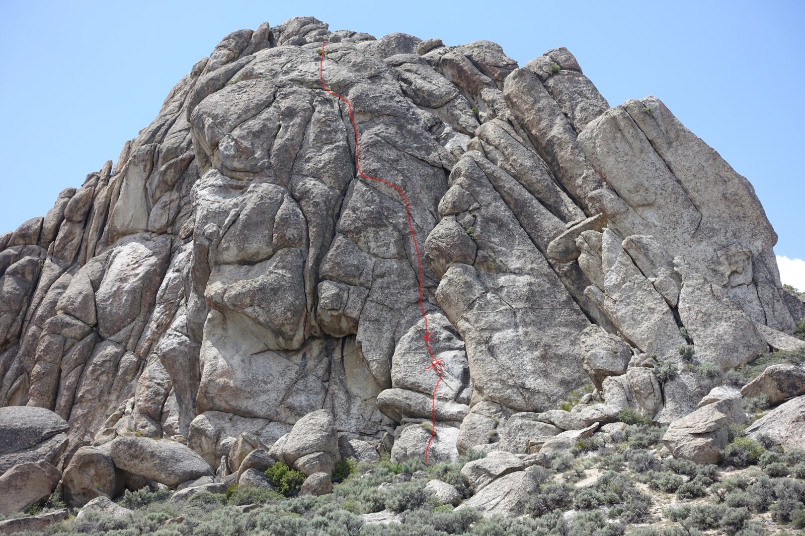
We also put up “Lava Lightning” on what we call “Sky Spire” the largest spire in the area. We did find a top anchor on top so it has been climbed (I would have thought so) but the anchor was over on a route to the right where some large flakes and cracks are. We placed two bolts on the lower face (5.8+) and then the climb moves straight into a finger crack which disappears (5.10a) and then into a main crack and back onto the face for a direct finish. It looked like a difficult walk-off so we put two ring-anchors there for a two-rope rappel. We found the rock to be excellent here.

We also put up a couple of shorter fun climbs.


The Road to Shangri La has two bulges and we put in one bolt at each bulge to protect the moves. You can also get small cams in at other places. Both climbs share a new two-bolt anchor at the top.
The grassy, green springs of Shangi La seems like a sensitive place that couldn’t withstand much traffic so we are not going to provide directions. If you find Shangi La, and you’ll know it when you find it, then you’ll probably see the short, fun climbs Road to Ruins and Road to Shangri La.
We were so tired at the end of the weekend we didn’t even make it home. We pulled over in Tahoe Sunday night at a hidden spot to sleep, then continued on early Monday.
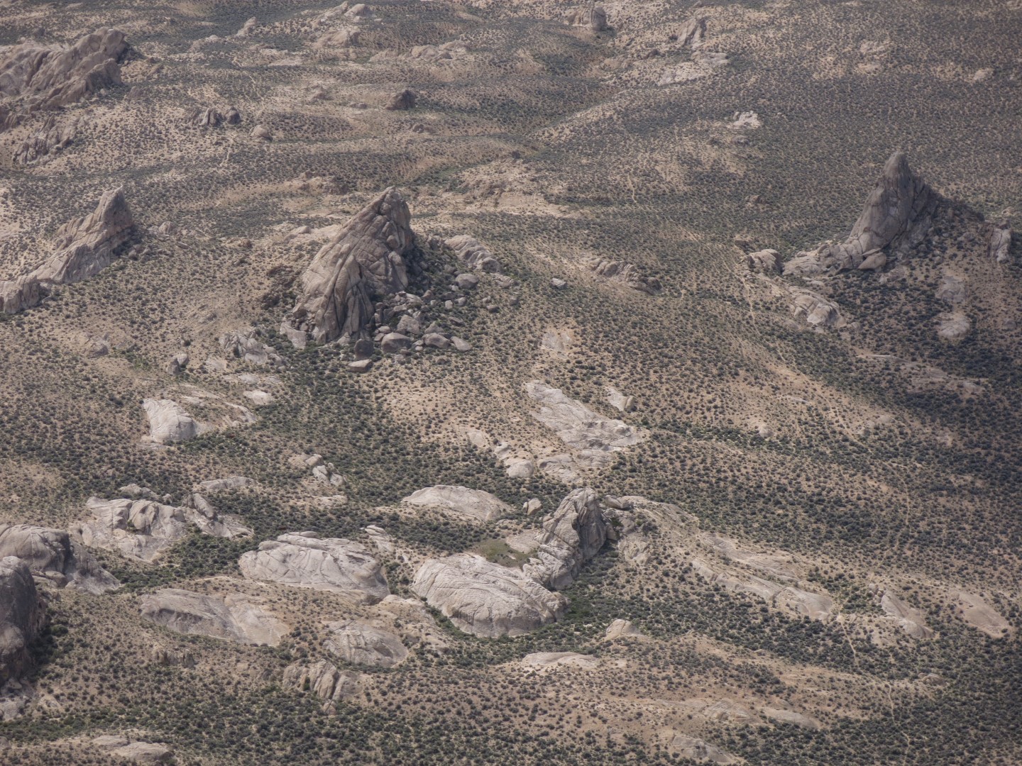
Elephant Land (aka The Lava Beds) isn’t likely to be a climber’s destination but it is a fantastic place for a multi-day remote climbing adventure.


Directions
The area can be found on maps as “The Lava Beds” (though its all granite) in Pershing County Nevada. Two roads approach Elephant Land from the south.
Take 80 east out of Reno and then head north on state route 447 just before Fernley. You’ll pass the small town of Nixon. Your turnoff is 43 miles past Nixon, past Pyramid Lake. The turn off from 447 is onto a well graded dirt/gravel road. If you get to Empire, you’ve gone too far. Coordinates are 40.43561, -119.33307.
Go up and over the Selenite Range on a good road. At the bottom there are some unlocked gates and three choices. Take the middle road.
Now try to stay on the main road that heads north, east then south. There are lots of ways to get lost but you want to end up here: 40.49521, -119.05603. Take the turnoff to the right. Now the road isn’t graded. Stay on the main trail that drops into a fun 4×4 creekbed and continues. You end up on the road here: 40.56434, -118.98687
The really nice amphitheater campsite I think is here: 40.57216, -118.99509 Its one of the first left hand turnoffs when you get to the rock of Elephant Land. You can walk from here to the “summit” with lots of Spires. Don’t miss Elephant Head Spring here: 40.56434, -118.98687. The road goes there but is badly eroded. You may need to walk. It’s a perfect place for e-bikes. There is a road that goes all the way around and ends up at Trail Springs, see below,
Easier 2WD Way In
There is an easier way in on a rough but 2WD (high clearance). Instead of turning right at 40.49521, -119.05603 continue north and turn right at the next half-way decent dirt track. Here: 40.56434, -119.07390. This is pretty flat until you hit a very steep hill. It’s exciting in an ATV so I don’t think a Sprinter could do it. Jeep-type only. This means you have a longer walk to get into “Elephant Land” but it’s less than a mile. But to get up to the summit area is 2-3 sandy miles.
Some History
The name Elephant Land comes from research that shows that desert rat and well known Nevada climber Alvin Mclane (passed away in 2006) discovered this place in the 60s. He was known for keeping secrets but for this place he didn’t. He brought National Geographic out here and the results were published in 1983’s “America’s Hidden Corners: Places off the Beaten Path”. I found an old copy on Amazon and bought it. The article’s author calls it a climber’s paradise and Alvin names it Elephant Land. It is better known as The Lava Beds for 4×4 enthusiasts and Chukka hunters, although it is misnamed as a miner looking for Tungsten in 1921 said, “…but so far as has been ascertained there is not a pebble of lava in the range”.
More Photos