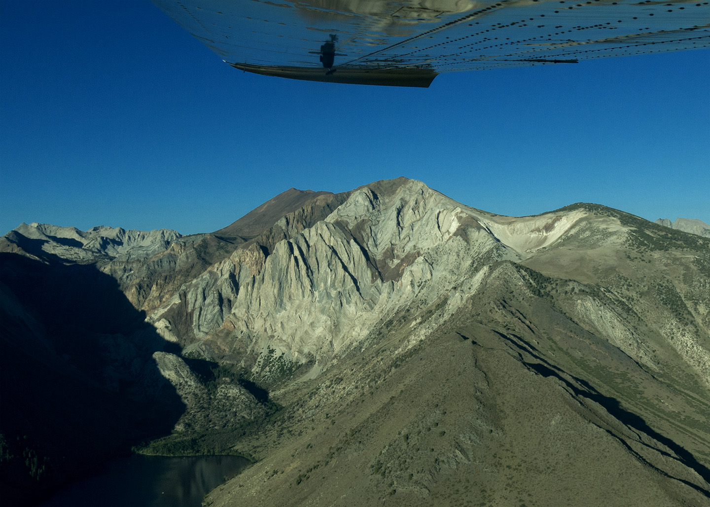
Laurel Mountain has been on our list to climb for a long time. It was mentioned in Peter Croft’s guidebook and then he recommended it to us as a great day out. Interestingly enough, it is also fairly close to Mammoth airport. Really close. In fact, we landed, got out our folding bikes, packed a small rope and some emergency climbing gear, rode “across the street” (highway 395) to Convict Lake and from there you look straight up at Laurel Mountain.
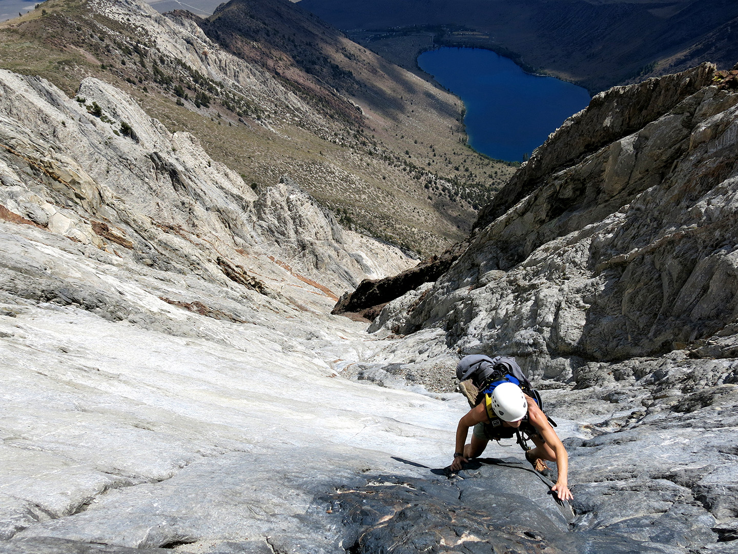
We free soloed it which means we didn’t use the gear or the rope, and at a rating of 5.2 to 5.4 it means it is fairly easy technically, but very exposed. And a bit scary at times. It was actually quite exposed as we climbed right up the middle of the mountain, up a granite gully washed clean with countless thunderstorms. It was awesome.
It struck me that there were three distances from the top of Laurel Mountain to Mammoth airport. Google maps said we biked 5 miles around the airport, across 395 and up to Convict Lake. Then we hiked another two miles and climbed one for a total of 8 miles. On Google maps, you can use the distance measuring tool to measure 3.9 miles from Laurel Mountain across to Mammoth airport.
However at the top of Laurel Mountain, looking down at the airport, I thought that would be the best zip line in the world, zipping down across 395 to the airport. It would also save a heck of a lot of loose downclimbing, hiking and biking. As kind of a geek, I used the Pythagorean theorem along with the 4,100 feet difference in elevation and came up with a zip line distance of 4.1 miles. Since a zip line isn’t very compatible with airplanes flying around an airport, its really kind of stupid idea. But it would be fun.


I’ve never done a zip line, but that would be the one to do!!!!!!
This is amazing I lived under Laura’s mountain for a week or so when I was working at mammoth. That’s awesome u climbed that that’s my backyard I never had a chance to climb it! Climb on!